Zamami Island, about two hours west of Naha (Okinawa) by fast ferry, is in the Kerama island group. Among the island's many charms is the fact that it does not host the deadly habu snakes found on Okinawa proper. Yonaguni is also habu-free.
The most common explanation for the fact that some islands are infested with habu and others are not goes like this. The islands that have snakes living on them were once connected. When the land bridges that connected them subsided below sea level, they became independent islands with shared animal populations. The islands that do not have snakes came into being separately, when sub-sea sedimentary rock layers were fractured, tilted, and pushed up above sea level.
Monday, November 7, 2011
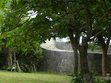
An Ancient Earthquake (Zamami Island)

The two dark stripes and their discontinuities tell of earthquakes that happened in ancient days. The larger right/left discrepancy is close to one foot. The one above that is a few inches.
Saturday, May 21, 2011
Losing a Civilization
When ten thousand lives are lost in an instant, when a way of life is wiped out in that same instant--all in one small part of the planet--you can say a civilization has been lost. That is what happened on March 11, 2011 in northeastern Japan. An earthquake coupled with a tsunami erased lives, housing, communications, transportation, and the fishing industry--the people and the way of life they created.
What's the difference between what happened in Japan's Tohoku and what happened in Yonaguni eons ago?
The simple answer is, in Tohoku, the stories were not lost. Everything was recorded in words and pictures. There were witnesses who survived.
Suppose there were witnesses who survived the Yonaguni disaster? Would the symbols and marks on stone tablets now preserved in the prefectural museum in Naha, Okinawa, be their stories?
Thursday, April 7, 2011
The Chiba Story (liquefaction) 2
Liquefaction at its most serious looks like Kobe after the Great Hanshin Earthquake: solid ground loses its solidity, and buildings topple. Now, Chiba prefecture has been afflicted by soil liquefaction.
What does it look like in Chiba?
It sounds cartoonish, but it is horribly serious.
For instance, you can only fill a glass half full. If it's on the table in your house, neither table nor glass is standing up straight because your house is leaning at a crazy angle. If you walk around outside in the affected areas, you might feel suddenly tall because heavy utility poles have sunk to a fraction of their former height. Or maybe you will feel suddenly dwarfed by odd mushroomlike structures sprouting from the streets, because manholes and their hollow concrete cylinders have floated up.
What do you do with a house that didn't fall down, but that won't let you sleep in it because you keep rolling out of bed? Let's hope there are smart engineers out there who can figure out a way to fix Chiba and the damage caused by soil liquefaction.
The Chiba Story (liquefaction)
Liquefaction! Do you picture the earth beneath your feet turning to water? Here's what happens, with a little help from Dr. Hazen, the first geologist to explain the phenomenon, back in the 20s.
When the soil is sandy and not well compacted, it's texture is grainy. If pressure is applied from above (for instance, a building is constructed on top of it) the soil can bear the pressure. Any water left in the sandy soil tends to be squeezed out. It moves from high pressure (under the building) to low pressure (anywhere not under the building).
But--if water is suddenly and repeatedly injected among the sand grains--instead of bearing the load, the grains roll around like well oiled ball bearings. The repeated shaking of unstabilized soil by earthquakes is one way water finds its way in. The sandy grains--separated from each other and the friction that holds them together--flow in a liquidy way.
This happened in San Francisco's Marina district in the 80s, in Alaska, in Kobe Port in the late 90s, and in New Zealand earlier this year. Now it is happening in Japan's Chiba prefecture.
Tuesday, April 5, 2011
Mangroves (2)
It is hard to love that which you do not know. Ocean Expo Park in the northern part of Okinawa does its best to show us the marine life that ecologists ask us to care about. We know we are supposed to protect mangrove forests because they guard the sub-tropical coastlines and provide a habitat where delicate creatures can be nurtured.
It is not hard to see mangrove forests above the waterline--tangled branches and lush leaves, not so different from other trees. But it is below the waterline that they do their best work. The photo below is from an exhibit at Ocean Expo Park.
Not many trees manage to shelter birds and fishes at the same time, but that is what mangroves do. In this exhibit, you can see them at work.

Friday, March 11, 2011
Earthquake! (2)
Here is a link to the explanation of the Japanese earthquake intensity scale. This scale describes the earthquake in terms of human perceptions.
http://en.wikipedia.org/wiki/Japan_Meteorological_Agency_seismic_intensity_scale
http://en.wikipedia.org/wiki/Japan_Meteorological_Agency_seismic_intensity_scale
Earthquake!
Here is a link to the record of the recent earthquakes that are devastating Japan. Please note that the times are NOT Japan time.
http://earthquake.usgs.gov/earthquakes/recenteqsww/Quakes/quakes_all.html
http://earthquake.usgs.gov/earthquakes/recenteqsww/Quakes/quakes_all.html
Subscribe to:
Posts (Atom)